When the rainy season comes this fall and the West Fork of the Chehalis River in Lewis County, Washington, rises from its summer lows, migratory fish such as salmon and steelhead will be in for a surprise. For the first time in decades, they’ll have access to an additional seven miles of upstream habitat for spawning and rearing juveniles.
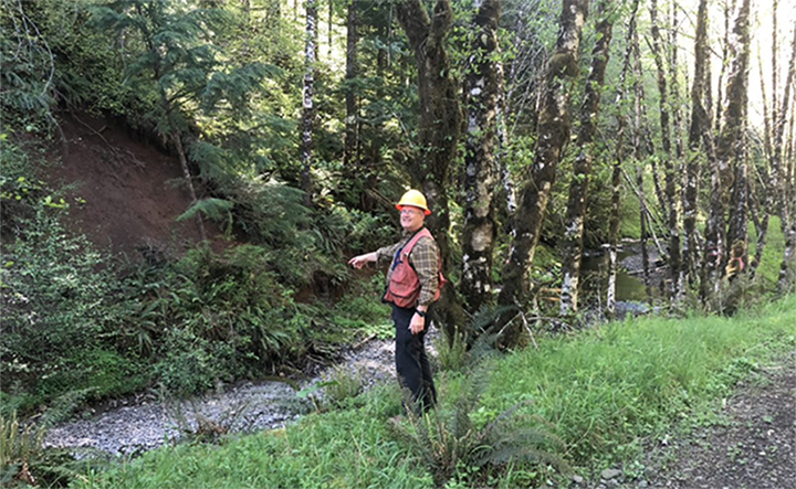
Fish passage has been blocked since the 1960s, when the river was rechanneled to accommodate a logging road. Construction on that road cut off waterflow from a natural oxbow — a bend in a river akin to a hairpin turn in a roadway — and created a 15-foot bedrock waterfall in the new channel that impeded passage further upstream.
But now, thanks to a collaboration between Weyerhaeuser and the Lewis Conservation District, work is in progress to decommission the human-made channel and return flow to the natural oxbow, once again giving fish access to the upper portions of the watershed.
GOING ABOVE AND BEYOND
The project originated in 2017 when our Western Timberlands team was laying out a harvest unit on our Pe Ell tree farm near the oxbow.
“A tributary stream flowing through the lower portion of the abandoned channel met our criteria for potential fish habitat, so our forest management practices required us to do a more extensive analysis,” says Don Schuh, a forest engineering specialist.
When our environmental scientists conducted the survey, they found a resident trout population in the tributary that had been isolated from downstream habitat for decades due to a partially collapsed puncheon, or wooden culvert, in the lower road crossing of the oxbow.
“We needed to remove the puncheon under the Forest Practices Act,” Don says, referring the Washington law that outlines specific responsibilities for companies around forest management. “The other barriers — the artificial channel and waterfall — predated the law, so removal wasn’t required.”
But Don and the Western Timberlands team recognized that in restoring fish passage at the lower crossing, it might be possible to restore the entire relic oxbow channel.
So Don commissioned a land survey and prepared a proposal to restore flow to the oxbow. The plan included building two new bridges to cross over the reestablished waterway and realigning the logging road.
“Based on our values of citizenship, sustainability and community, we wanted to find a way to do the right thing,” Don says. “But full restoration carried a pretty hefty price tag, about $1.2 million.”
SEEKING A CO-SPONSOR AND PARTNER
Other complexities — including community outreach, consultation with the area’s Native American tribes, and coordination with various government entities — prompted Don to seek out a third-party partner to bring their expertise and credibility to the project.
To that end, Don attended a working group meeting of the Office of the Chehalis Basin.
The office was created by the Washington State Legislature after floods in 2007 and 2009 devastated portions of the watershed, the state’s second-largest river drainage basin, overwhelming fish and wildlife habitat and resulting in hundreds of millions of dollars of economic damages. Represented by a diverse group of state and local agencies and tribal leaders, the office aims to reduce future flood-related damage in the region while restoring habitat for salmon and other aquatic species.
“I laid out the opportunity and our plans,” Don says. “I was seeking input, looking for a project co-sponsor and hoping state matching funds might be available to fully restore the oxbow.”
Bob Amrine, a project manager at the Lewis Conservation District, watched Don’s presentation with increasing interest. LCD is a local, nonregulatory agency that helps landowners resolve conservation issues on their property. Bob and Don had worked together on a previous project, forming the basis for a strong collaborative relationship.
“We’ve been involved in dozens and dozens of fish-passage projects over the years,” Bob says. “They tend to be small but important, opening up a half-mile to a mile of upstream habitat. Seven miles definitely caught my attention.”
Bob brought a proposal to co-sponsor the project to his board, which agreed. “At that point, we were at the mercy of finding funding,” he says.
It took a few years, but in June 2020 LCD received funding from the Chehalis Basin Strategy’s Aquatic Species Restoration Plan, administered by the Washington Department of Fish and Wildlife, to support up to 49 percent of the project’s costs, with Weyerhaeuser covering the rest.
A FINAL PUSH
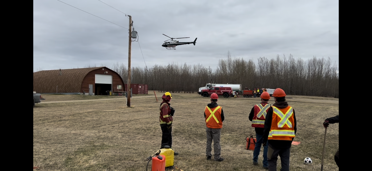
Last summer, the project team conducted test drilling for bridge pylons and submitted a permit application to the Army Corps of Engineers, which regulates construction projects on certain U.S. waterways in flood-controlled or environmentally sensitive areas. The Corps granted the permits in March.
We also shared our plans with nearby tribes. Plans included a commitment to hire a qualified third party to perform an archeological survey at the project site to identify, preserve and protect any tribal artifacts or cultural resources.
Once the archaeological survey was completed, the tribes gave the project their blessing.
“Restoring and reconnecting access to spawning habitat is the most important action we can take to help salmon, steelhead and lamprey survive and give them a fighting chance to someday thrive once again,” Tyson Johnston, vice president of the Quinault Indian Nation, said in a press release about the project.
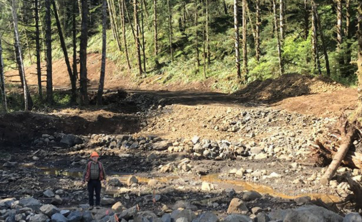
This April, construction crews started removing landslide debris from the relic oxbow. In June, when the water levels in the river drop and the fish breeding season ends, construction on the bridges will begin. In September, the team expects to start diverting water flow into the relic oxbow.
“We’ll reflow the oxbow in three phases to minimize the effect of sediment on downstream habitat and water quality,” Don says. “By October, we expect the relic oxbow to be fully flowing again. The isolated trout population will once again be able to access downstream habitat. And salmon and other migratory fish will have seven more miles of upstream habitat.”
A SUSTAINABLE FUTURE
In conjunction with Weyerhaeuser and the Washington Department of Fish and Wildlife, LCD will monitor up- and downstream fish populations for the next 10 years, and there’s a great deal of optimism about the project’s long-term success.
“We encourage everyone to safeguard our natural resources and restore habitat anywhere we can,” Bob says. “That’s how we protect our future. Weyerhaeuser has stepped up in a big way.”
And while the migratory fish might soon return to the upper portions of the West Fork Chehalis River watershed, our work to protect native fish populations is by no means finished.
“This restoration project is one of many that demonstrate our ongoing commitment to conserve wildlife habitat across our timberlands, including identifying and repairing road-related fish barriers,” Don says. “There’s more to come.”
The bridge will span 110 feet across the channel at this location.
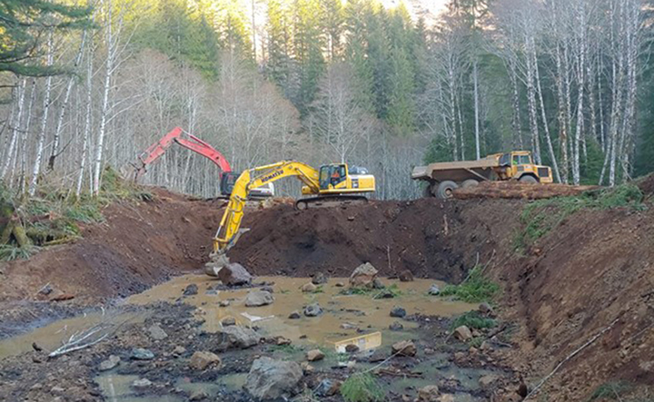
Channel excavation this May near the upper bridge site, removing construction spoils and landslide deposits to uncover the upper half of the oxbow channel.